


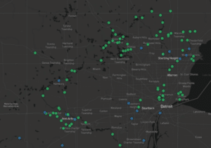
Since 2015, HRWC has worked with Dr. Branko Kerkez, associate professor of civil and environmental engineering at the University of Michigan, and his Digital Water Lab to develop a remote network of low-cost sensors across the Huron River and its tributaries. This sensor network has been vital in understanding and monitoring flow dynamics throughout the Huron River watershed. The remote network allows HRWC, river users, and decision makers to observe and adapt to changes in flow dynamics across seasons, conditions, and long-term climate changes.

This partnership with the Digital Water Lab team saves HRWC staff time and resources while collecting and transmitting real-time water level data that could not otherwise be obtained. Without this partnership only three United States Geological Survey stream gauges remain for 130 miles of the Huron River. In tandem with data collected by HRWC’s Chemistry and Flow Monitoring Program, this real-time water level data allows flow to be computed and accessible via the web. It is used to coordinate and manage flow to best benefit the river ecosystem and river users, including by dam managers throughout the Huron.
In 2014, HRWC established the Huron River Dam Managers Network. The network consists of representatives from the entities operating the Huron River’s 17 dams. Together they develop recreational, hydropower, and ecological flow targets. The dam managers utilize the hydrologic data from the sensor network to inform dam management decisions for protecting public safety and aquatic ecosystems.
The sensors are also paired with HRWC’s automatic water samplers (autosamplers) at three long-term sites across Wayne, Livingston, and Washtenaw counties. The sensor and autosampler work together to monitor flow and collect water samples under optimal storm conditions. This enables the collection of storm data without the need or risk of unnecessary manual oversight and travel. The flow and water quality data collected by the nodes and autosamplers determines the timing and quantity of pollution entering streams, helping to improve stormwater management.
Together, HRWC and the Digital Water Lab team have made strides in expanding and improving the sensor network. The partnerships will continue to explore the potential of sensor networks and lead the way for smarter water management in the Huron.
Click here to view data from the real-time sensor node network.