


The Huron River’s health depends on the remaining natural areas in the watershed. Natural lands reduce surface water runoff to our rivers, lakes and streams by facilitating the slow infiltration of water into soils and groundwater. Natural lands also sequester carbon dioxide from the atmosphere and store carbon in plants and soils, and land preservation is an essential component of the fight against Climate Change. About 44% of the Huron River watershed remains undeveloped today, and is classified as forests, wetlands, and fields.
HRWC’s Natural Areas Assessment Program
The goal of the Natural Areas Assessment Program is to protect the remaining natural areas in the Huron River watershed from development. HRWC has identified the remaining natural areas in our Bioreserve Map (linked). Through this program, HRWC:
- Helps local communities, conservancies, and state and county agencies prioritize which natural areas to protect (with limited funding for land protection, we can’t protect all of our natural areas from development);
- Works with local governments to develop policies and ordinances to protect natural areas;
- Provides information to landowners interested in conserving/protecting their land from development, and learning more about the natural features on their property.
The Bioreserve Map
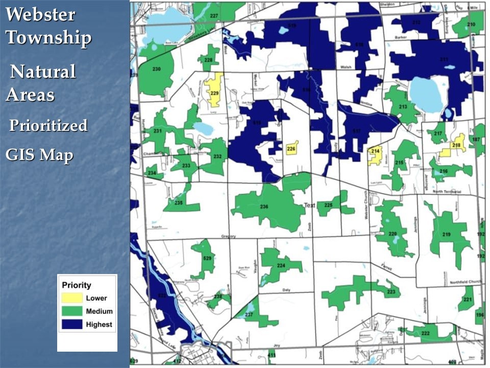
HRWC’s Bioreserve Map identifies the natural areas across the Huron River watershed. We created the map using aerial photographs taken over five counties (Oakland, Livingston, Wayne, Washtenaw, and Monroe), and drawing boundaries around what could be identified as woodland, wetland, or open field. This resulted in 1,700 sites, totaling 247,000 acres, which is approximately one-quarter the total area of the watershed. HRWC collaborated with students from the School for Environment and Sustainability at the University of Michigan to develop a computerized model to rank each of those sites as high, medium, or low priority for protection. Ranks were based on available GIS data including size and connectivity of the area, presence of water features related to water quality and supply, diversity of geology and topography (as proxies for potential biodiversity), and overlap with historical high quality vegetation types.
Report: Identifying And Ranking Natural Areas in the Huron River Watershed
Natural Areas Field Assessments
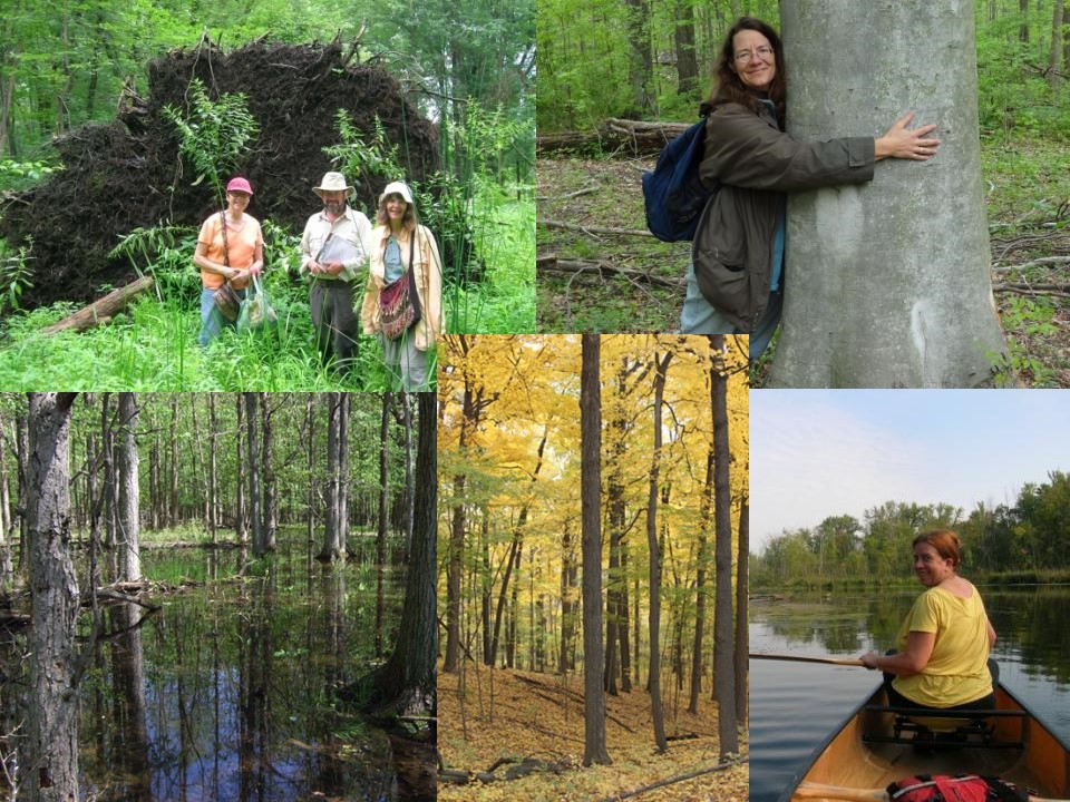
To gather more information about the natural areas identified in the Bioreserve Map, HRWC created a rapid ecological field assessment method adapted from assessments performed by professional ecologists at the Michigan Natural Features Inventory (MNFI). HRWC’s field assessment protocol is designed to allow volunteers to collect meaningful information about the ecological quality of a site without extensive training or background in ecology. Surveyors walk around a property, noting plant species and ecological characteristics such as vegetation structure (tree size distribution, percent cover of herbaceous vs. woody plants, etc.), and the presence of “checklist species”, or plants that are indicators of either high ecological integrity or of human disturbance.
The data collected in the field is analyzed by HRWC staff, and scores are generated to rank the level of ecological integrity and restoration potential of each ecosystem area on a property. Results from the field assessments are compiled into a Field Assessment Report, shared with property owners, land conservancies, and local communities to aid in planning and preservation efforts.
Field Assessment Reports do not provide land management or restoration recommendations, and HRWC does not offer individualized land management plants. However, if landowners are interested in restoring or managing the ecosystems on their property, or permanently protecting their property via a conservation easement, HRWC can recommend conservancy groups, restoration companies, or general resources for landowners to pursue.
Get Involved
HRWC conducts field assessments on properties that are over 10 acres in size and have have large areas of remaining forest, wetland, or prairie habitats.
Landowners
Over 400 landowners throughout the Huron River watershed have already learned about the natural areas on their properties through HRWC’s field assessments. If you are interested in a field assessment of your property, contact Kris Olsson at kolsson@hrwc.org or Kate Laramie at klaramie@hrwc.org.
Volunteers
The number of field assessments that HRWC conducts varies annually based on landowner interest and program funding. However, HRWC is always looking for volunteers who have plant identification experience and/or a background in terrestrial ecology. If you’re interested in volunteering for the Natural Areas Assessment Program, contact Kate Laramie klaramie@hrwc.org.
Communities and Conservancies
HRWC is seeking partnerships with local governments, conservancies, and parks departments to actively pursue strategies to permanently protect high quality natural areas. HRWC will work with partners to assess sites, hold training sessions, and develop ordinances and policies to protect natural areas.
Contact Kris Olsson to find out more about how you can be involved. kolsson@hrwc.org
