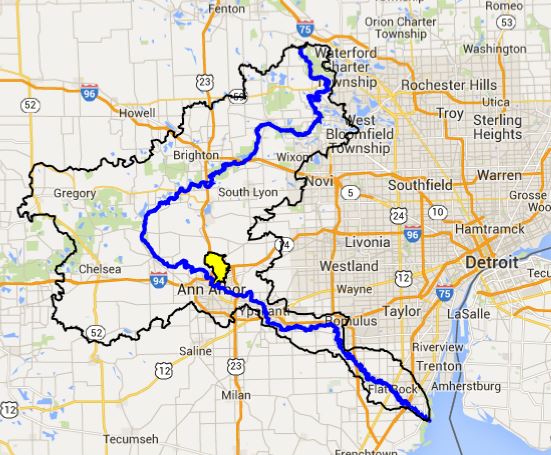
Profile
Traver Creek flows off the western ridge of the Fort Wayne Moraine and down into Northeast Ann Arbor before emptying into the Huron River in the Lowertown neighborhood. Before European settlement, the creekshed was covered with oak-hickory forest. Today, the creekshed has two distinct areas, with its northern highlands predominantly farms and rural homes, and its southern region part of the urban area of Ann Arbor. The water quality of the river is clearly affected by the type of land through which it flows.
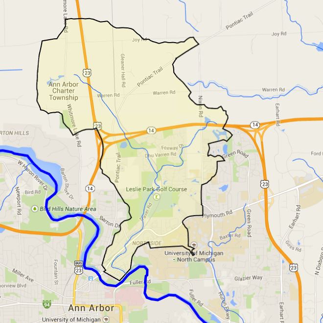
Traver creekshed is small, covering only 7 square miles, and the creek is also quite short, made of a main branch that runs 4.5 miles, and one tributary that runs 1.8 miles. The creek has a steep slope for the Huron River Watershed, dropping 163 feet over the 4.5 mile run of the main branch (36 feet per mile). There are 12 ponds (open water <5 acres) scattered through the creekshed; most of them are used for irrigation and part of the course in the Leslie Park Golf Course or as stormwater detention ponds near residential housing.
Traver creekshed falls primarily in the City of Ann Arbor (south of M-14) and Ann Arbor Township (north of M-14), and a small section in Northfield Township. The creek is a county drain and under purview of the Washtenaw County Water Resources Commissioner.