Profile
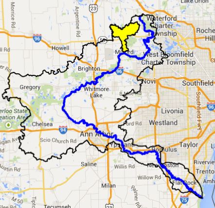
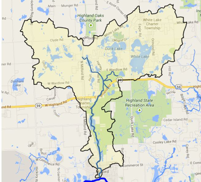
Originating in Highland and White Lake townships, Pettibone Creek flows through Milford Township and meets the Huron River at the Mill Pond park in the Village of Milford, Oakland County. The creekshed lies in a glacial landscape of coarse sand and gravel deposits, and was once nearly entirely “oak barrens.” Oak barrens are now considered a critically imperiled ecosystem by the Michigan Natural Features Inventory due to their massive clearing for agriculture during European settlement and continued development. Tamarack swamps and marshes lined its valleys. The area is now home to many sand and gravel operations and residential areas.
Pettibone creekshed is a land of lakes. There are 30 lakes (open water > 5 acres) and 44 ponds (open water < 5 acres) in the creekshed. The two largest lakes, there White Lake (540 acres) and Duck Lake (340 acres), as well as many of the smaller lakes, are surrounded by residential housing. However, there are several smaller lakes that still have natural shorelines.
Due to the geology of the area, much of the water flow in the creekshed is through groundwater, and the actual visible creek is quite small. Only 19 miles of branching stream channels make up the creek’s ecosystem, but it drains 22 square miles of land. In contrast, Fleming creekshed is about the same size but contains 48 miles of streams. Pettibone Creek’s average slope is 14 feet per mile, which is on par for the Huron River Watershed as a whole.