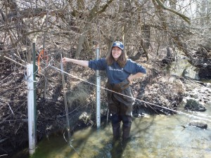
On March 17, an enthusiastic team of four volunteers took the first creek measurements of the year in Millers Creek. Millers Creek is located in northeast Ann Arbor and runs the length of Huron Parkway. The volunteers were measuring the speed of the water, which when multiplied by the stream’s cross section, tells us the total amount of water flowing down the creek.
When rain falls on an area that is full of pavement and other surfaces that do not allow water to percolate into the ground, the rain quickly flows into the storm sewer and then into a nearby creek. The result is that the amount of water flowing through a creek can increase dramatically after a storm, causing erosion problems and washing away the creek’s fish and insects and their homes.
Millers Creek is the poster child of these extreme (or flashy) stream flows. In 2008 and 2009, HRWC and its partners distributed rainbarrels and built raingardens in the Millers Creek watershed in order to hold more rain on the land and prevent it from entering the creek. In addition, we held public meetings and informed homeowners of the problem and what they could do. We are measuring water flow in 2010 to see whether storm water enters the stream more slowly after adding storage upstream. We hope the water management improvements were extensive enough to show an effect right away. We will also continue to monitor the biology and the physical habitat of the stream. For more information, see the Millers Creek website.


