


A SPECIAL EARTH DAY TRIBUTE
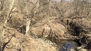
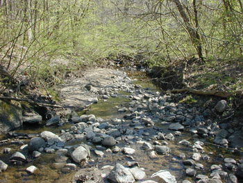
Mostly hidden from easy view, creeks are all around us. If you have ever hiked one just to see where it went you will want to read this inspiring essay “Finding Millers Creek” by author and HRWC volunteer Pat Chargot. Thank you Pat for exploring and protecting our local creeks.
Enjoy and happy Earth Day everyone!
Check out Pat’s 2017 Earth Day tribute essay “Exploring the Home Waters.”
About Millers Creek:
Millers Creek is one of the smallest in the Huron River system – draining only 2.4 square miles of surrounding land. However, this creek is the steepest tributary to the Huron River by far, with a gradient of 52 feet per mile compared to other tributaries which usually range between 10-15 feet per mile. In the half-mile from Hubbard Road to Glazier Way, it is extremely steep – dropping more than 70 feet!
Until the 1950’s, the creekshed was largely a forested and agricultural area to the northeast of Ann Arbor. After that time, the University of Michigan bought 800 acres to establish the North Campus, and by the 1960’s, large companies like Parke Davis moved into the area and several residential neighborhoods were built. In 1964, the City of Ann Arbor straightened part of Millers Creek and placed portions of it underground when it constructed Huron Parkway. Hotels, commercial centers, office buildings, and more residential areas were added in the 1990’s when this area was the fastest growing part of Ann Arbor. The U-M now owns about one third of the land in Millers creekshed. All of it falls within the City of Ann Arbor. Learn more at HRWC’s Info Stream.