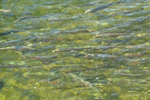
The future of fish

This past week I had the opportunity to attend a two-day workshop exploring the connections between streams, climate change, and fish populations. The centerpiece of this workshop was a climate change-fish vulnerability model developed by a partnership between the US Geological Survey (USGS), Michigan State University, and state agencies in Michigan, New York, Wisconsin, and Minnesota. This model makes predictions of how likely stream fish populations are to change under a range of climate change scenarios. The information can be used by water resource managers trying to understanding which fish and which streams are most at risk from climate change.
Nuts and bolts of the fish vulnerability model
Global circulation models (GCMs) are used by climate scientists to make predictions about how the Earth’s climate is going to change in the future. There are a wide variety of GCMs, all based on differing assumptions, and as a result they produce different results in terms of the predicted rates of climate change. Interestingly, all of the models do share some commonalities:
- The Earth is warming
- Winter is going to warm more than the summer
- Winters will be wetter
- The northern US will warm more than the south
- Inland areas will warm more than along coastlines
- Extreme events will be more common
The fish vulnerability model produced by the USGS and its partners uses ten of these differing GCMs and combines their climate predictions with predictions of fish presence and absence. An example is the best way to show how this works. Let’s say a particular stream holds brook trout currently. Due to temperature increases and changes in water flow by 2050, this stream is predicted to have lost the fish under GCMs #1-7. However, under GCMs #8-10, the fish is still expected to remain in the creek. Therefore, 7 out of the 10 climate change scenarios predict that the fish will be eliminated from this creek by the year 2050. The fish’s vulnerability to climate-change is said to be 70% for this particular stream.
The USGS and its partners ran this model across the Michigan, Wisconsin, and Minnesota for 14 species of fish (i.e. brook trout, brown trout, mottled sculpin, northern pike, smallmouth bass, common carp, etc). For each fish and on every stream in these states, they have produced a predicted vulnerability for that species- the percentage chance that the fish will disappear in the future.
Management implications
If the model predicts a fish to be missing from a stream under all 10 of the GCMs, this means that even under lenient climate change scenarios, this fish will disappear and managing this stream for the preservation of the fish is most likely to be a lost cause. The predicted vulnerability of this fish in this stream is 100%.
If the model predicts a fish to be present in a stream under all 10 GCMs, this indicates that this fish is very resilient against climate change, or that the stream is not expected to change much, even under the most severe climate change scenarios. Managers can leave these streams alone; the predicted vulnerability of this fish in this stream is 0%.
However, if the model predicts that under some GCMs the fish will leave, and under other GCMs that the fish will stay, then water resource managers have something to work with. This model result means that the stream may be borderline for the fish in the future, and managers have a chance to keep the fish there if they can work towards making the stream more “climate change resilient”. Management activities should center on promoting rainfall infiltration and groundwater recharge. Activities like building rain gardens, maintaining and expanding our natural areas, and reducing the amount of impervious surface will provide greater opportunity for rain to percolate into the ground rather than running overland to the stream.
Groundwater is the key to climate change resiliency because in the summer when fish populations are most stressed due to high water temperatures and low rainfall, groundwater inputs maintain flow and cooler temperatures. Groundwater temperature is usually the same as the average annual air temperature because of the length of time the water spends underground. Therefore in the summer, groundwater is relatively cold as compared to surface water. Also, groundwater is released consistently to the stream, unlike sporadic rainfall, thus giving constant flow even under drought conditions.
Stay Tuned…
The USGS is in the process of developing a web-based map to display their model results so that the information can be readily used by water resource managers. This web-based map and the model results are not ready for public consumption, but I will post a link from this blog when it is.


