Profile
 Once covered by oak barrens, oak and hickory forests, and marshes and swamps, this creekshed was home to Chippewa and Potawatomi Native American tribes. Initial European settlement centered on the transformation of the open barrens for agricultural production and the forested areas for timber. Over the past few decades agriculture has been quickly diminishing as land has transferred to suburban uses.
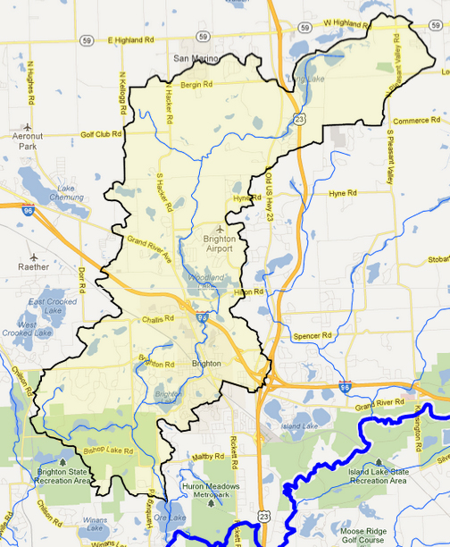
This 34 square mile creekshed lies within Livingston County and comprises all or portions of Hartland, Oceola, Genoa, Brighton, and Hamburg townships and the City of Brighton. There are 34 lakes (open water >5 acres) and 34 ponds (open water < 5 acres) in the South Ore creekshed. The three biggest lakes are Woodland Lake (258 acres), Long Lake (178 acres), and Brighton Lake (163 acres).
South Ore Creek’s main stem and its tributaries total 36 miles of waterways. The main branch starts at the outflow of Maxfield and Long Lakes. From there, it flows southwest until it reaches Woodland Lake, then flows south through the City of Brighton, and downstream to the Brighton Lake impoundment within the southwestern portion of the City of Brighton. Downstream of Brighton Lake, the creek flows through Brighton State Lake Recreation Area, which greatly helps South Ore Creek’s water quality toward the mouth of the creek. After exiting Brighton State Rec Area, the creek empties into Ore Lake, which then drains into the main branch of the Huron River. Throughout its run, the main branch of the creek drops 108 feet and has an average gradient of about 6 feet per mile, which is flat when compared to other creeks in the Huron River Watershed (Fleming and Norton Creek are 13 feet per mile, for example).
HRWC Documents

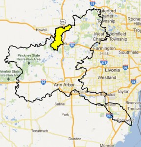
Location of South Ore creekshed in the Huron River Watershed


