 In order to keep the river system healthy, we need to encourage compact development in areas with existing infrastructure (like cities and villages and other urban areas), and preserve natural and rural areas so they can continue to provide the ecological services necessary to maintain quality of water, air, land, and life. (See our “Smart Growth Publications” webpage for more details)
Here are three recent articles that underscore this message.
A recent blog posted on the Smart Growth Network Newsletter (originally posted by the Nature Conservancy) bemoans the prevalence of zoning codes that do not allow higher density (i.e. that have minimum lot sizes), since that results in sprawling development patterns that consume more land and create more impervious cover per household. Given that all the communities in the watershed currently have these kinds of zoning codes, we have a lot of work to do to promote sustainable land use patterns.
Another SGN Newsletter post (from the Washington Post) gives a little perspective on what density looks like by comparing densities in dozens of urban areas throughout the world, and showing that most U.S. cities have plenty more room for more population and density. Even New York City has about a third of the density as London, England.
And finally, a report from the Transportation Research Board (part of the U.S. Academies of Sciences) finds that transit oriented development (which designs compact development around nodes of mass transit) greatly reduces greenhouse gas emissions, due to reduction of automobile usage.
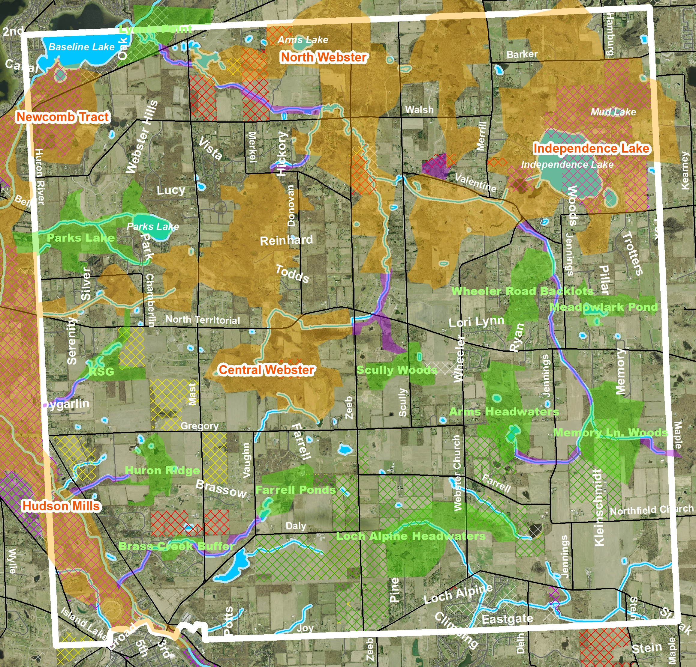
HRWC has many programs that are encouraging communities to take a look at their land use policies, including Green Infrastructure and Climate Resilient Communities. The Green Infrastructure project maps out communities’ networks of natural areas so that they can guide development to areas appropriate to growth. As climate change impacts our watershed with increasing rainfall, the importance of managing stormwater in urban areas, maintaining natural areas and keeping development out of floodplains and low lying areas becomes increasingly important.